For experts.
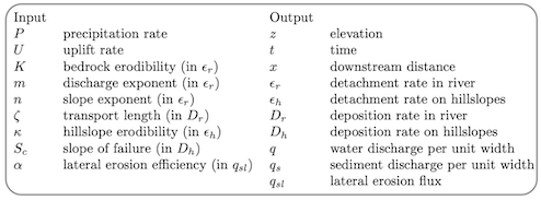
All the following equations and parameters are described in the Theory
page.
During geological time, if the climate becomes wetter, by how much
does the altitude of the mountain decrease?
This question has been the subject of a famous controversy (e.g. Molnar and
England, 1990; Whipple et al., 1999; Dielforder et al., 2020). This is known to be a
complicated problem that depends on the co-evolution of precipitation with
altitude and rainfall variability (Roe et al., 2003; Lague, 2014). Let’s keep it
simple and look at what happens if the rains are constant and homogeneous.
By comparing the maximum altitudes for simulations (those with m = 0.5
and n = 1) with different values of precipitation rate P, we find that the
maximum altitude zmax ~ P-0.9. This means that if P is multiplied by 2, the
mountain relief will be divided by about 2 (a bit less). Can we predict this
result?
For that, we can try to predict the relationship between the slope and P at
dynamic equilibrium, when the erosion rate balances the tectonic uplift rate. The
mountain relief is actually the integral of slopes along river path, but the resulting
scaling with precipitation is the same as long as P is homogeneous.
If we neglect hillslope processes (only rivers) and lateral erosion, the mass balance equation is

At dynamic equilibrium, the elevation does not change anymore and thus

Replacing the erosion and deposition rates by their formulae (see Theory page) we obtain


Thus, in simulations with m = 0.5 and n = 1, the slope S scales with
P-0.5(1 +  ).
).
As explained in the Theory page, ζ si proportional to the reverse of the settling
velocity of transported grains in rivers, and thus is larger for finer sediment
grains. This is true for an ”instantaneous” description of sediment transport
(Davy and Lague, 2009) but in LEMs, ζ is an apparent parameter that
captures also periods without transport, as explained in the Data Repository of
Guerit et al. (2019). If the climate corresponds to rare and short floods, ζ
increases.
What does a high ζ value imply? In the case that ζ >> 1, the previous
slope-rainfall scaling reduces to S ~ P-0.5, ie. the slope scales with the
reverse of the squared rainfall rate. In other words, when P is multiplied by
2, S is only divided by 1.4. And if ζ is very low? In that case, if ζ << 1,
S ~ P-0.5(1 +  ) ~ P-1.5. The scaling that we found by plotting the maximum
elevation of the mountains for different rainfall P (S ~ P-0.9) lies between these two
end-member cases.
) ~ P-1.5. The scaling that we found by plotting the maximum
elevation of the mountains for different rainfall P (S ~ P-0.9) lies between these two
end-member cases.
The value ζ = 1 used in these simulations is indeed intermediate and it
is therefore not surprising to find a scaling law that is also intermediate.
Rmq: A large ζ >> 1 makes the deposition term Dr in Equation 1 very small (because
Dr = Qs∕ζQ). It can be negligible compared to the detachment rate term ϵ. This means that once a
particule of the riverbed is detached, it is transported and deposited eventually very
far, after a very long transport distance larger than the total river length. This is the
definition of a ”Detachment-limited” river system in geomorphology. On the contrary, if
ζ << 1, then Dr becomes significant and any particle detached from the riverbed will
have a non-negligible probability of redeposition at close range. This is the definition of
a ”Transport-limited” river system, because the variation of the riverbed elevation
depends on the capacity to carry sediment rather than to detach particules. Detachment
and Transport-limited systems have very different predictions in terms of transient river
behaviour. Experts can learn more by reading Whipple and Tucker (1999, 2002). The
product Pζ determines the very detachment or transport limited nature of rivers and of the
whole landscape. Values Pζ > 1 tend to generate detachment-limited river topographies
whereas Pζ < 1 tend to generate transport-limited topographies. Natural systems tend to
have a large range of Pζ values but with a significant proportion with Pζ ≤ 1 (towards
transport-limited behaviour). Experts can learn more by reading Davy and Lague (2009); Guerit
et al. (2019).
Conclusion? Yes the model prediction is consistent with the underlying theory
(ufff). The theory predicts that a simple parameter changes a lot the scaling
between mountain elevation and rainfall. This parameter depends on the size of
transported grains. This is a nice example of how the characteristic of a
small ”nothing” (sediment particule) potentially determines the morphology
of a big thing (the whole landscape). It remains to be understood what
controls the size of grains transported by rivers. There is an important, poorly
explored consequence: if Pζ is small then S ~ P-1.5. In that case, for low P
values, ie. arid climate, a small change in P has a dramatic effect on S.
For wetter climates with larger P the change is on the contrary modest.
Obviously, this is not all the story. This analysis holds for m = 0.5 and n = 1, it
must be reevaluated for other values. In particular, accounting for detachment
threshold in the ϵ detachment law and for the full range of floods in rivers changes
things. Experts can learn more by reading Tucker (2004); Lague (2014); Deal
et al. (2017). Vegetation and most probably glaciers play a role too.
And what about the scaling with tectonic uplift rate U? Look at the
simulations and verify the predictions of the theory using the same approach as
above.
Suggestions for teaching:
Discuss the predictions for different m and n values.
Discuss the limitations of the model concerning the analysis of the S-P scaling
(constant and homogeneous rainfall rate, no weathering, no vegetation, no glaciers,
only one grain size, realism of the dynamic equilibrium hypothesis, response time of
topography to a change in P etc...)
Discuss how to test these predictions on natural examples using Google Earth and
global climate data.
References
Davy, P., and D. Lague (2009), The erosion / transport equation of landscape evolution models revisited, J. Geophys. Res., 114, doi:10.1029/2008JF001146.
Deal, E., A.-C. Favre, and J. Braun (2017), Rainfall variability in the himalayan orogen and its relevance to erosion processes, Water Resources Research, 53(5), 4004–4021.
Dielforder, A., R. Hetzel, and O. Oncken (2020), Megathrust shear force controls mountain height at convergent plate margins, Nature, 582, 225–241, doi:https://doi.org/10.1038/s41586-020-2340-7.
Guerit, L., X.-P. Yuan, S. Carretier, S. Bonnet, S. Rohais, J. Braun, and D. Rouby (2019), Fluvial landscape evolution controlled by the sediment deposition coefficient: Estimation from experimental and natural landscapes, Geology, 47(9), 853–856, doi:10.1130/G46356.1.
Lague, D. (2014), The stream power river incision model: evidence, theory and beyond, Earth Surf. Proc. Land., 39(1), 38–61, doi:10.1002/esp.3462.
Molnar, P., and P. England (1990), Late Cenozoic uplift of mountain ranges and global climate change: chicken or egg?, Nature, 346, 29–34.
Roe, G. H., D. Montgomery, and B. Hallet (2003), Orographic precipitation and the relief of mountain ranges, J. Geophys. Res., 108(B6), 2315, doi:10.1029/2001JB001521.
Tucker, G. (2004), Drainage basin sensitivity to tectonic and climatic forcing: Implications of a stochastic model for the role of entrainment and erosion thresholds, Earth Surf. Proc. Land., 29, 185–205, doi:10.1002/esp.1020.
Whipple, K. X., and G. E. Tucker (1999), Dynamics of the stream-power incision model: implication for heigth limits of mountain ranges, landscape response timescales, and research needs, J. Geophys. Res., 104, 17,661–17,674.
Whipple, K. X., and G. E. Tucker (2002), Implication of sediment-flux-dependent river incision models for landscape evolution, J. Geophys. Res., 107(B2), 2039, doi:10.1029/2000JB000044.
Whipple, K. X., E. Kirby, and H. Brocklehurst (1999), Geomorphic limits to climate-induced increases in topographic relief, Nature, 401, 39–43.